
Postal Coverage in Marion County
County parcel data contains address-bearing locality and postal combinations, but it is not a USPS-certified coverage list. The selected entries below are examples from the county’s current `SITUSCSZ` inventory. They show why an exact address must be checked before its mailing form is reused. The Marion County ZIP code directory should be read as a record-navigation aid, not as a claim that every listed postal area lies wholly inside one city or one county.
| ZIP | Areas covered in county parcel data | Post office | Notes |
|---|---|---|---|
| 97002 | Aurora locality string | Not verified in the research | Northern county postal area that can extend beyond county lines. |
| 97032 | Hubbard locality string | Not verified in the research | Use the actual address because cross-county delivery patterns are possible. |
| 97303 | Keizer and Salem locality strings | Not verified in the research | Postal locality and municipal context are separate questions. |
| 97360 | Mill City locality string | Not verified in the research | Cross-county geography is possible, so confirm the specific address. |
| 97071 | Woodburn locality string | Not verified in the research | Northern county locality entry; do not infer county membership from the postal label alone. |
| 97301, 97302, 97304, 97305, 97306, 97317 | Salem locality strings | Not verified in the research | County data shows several Salem postal combinations; a legacy anomalous Salem value is not coverage evidence. |
The county inventory also includes other locality strings, including Aumsville, Detroit, Gates, Gervais, Idanha, Jefferson, Lyons, Mount Angel, Scotts Mills, Silverton, Stayton, Sublimity, Turner, and St. Paul. It even shows two St. Paul combinations. Those observations are reasons to verify an individual address, not reasons to publish an assumed master postal list.
Confirm Marion County ZIP Code Through USPS
USPS ZIP Code Lookup is the verified route for confirming a deliverable address and its current preferred city spelling. Use the full address that needs confirmation. A city name by itself is not enough, and a result should not be read as proof of an owner, a current resident, a parcel boundary, a voting precinct, or local-government jurisdiction.
| Start with | A known street address, including the correct unit where one applies. |
|---|---|
| Use | The official USPS address lookup, not a county parcel list as a delivery certification tool. |
| Retain | The current postal result and preferred city spelling next to the source date. |
| Do not infer | Parcel ownership, municipal limits, voting status, or the people at that address. |
The official USPS lookup screen is the appropriate source for an address-level postal confirmation.
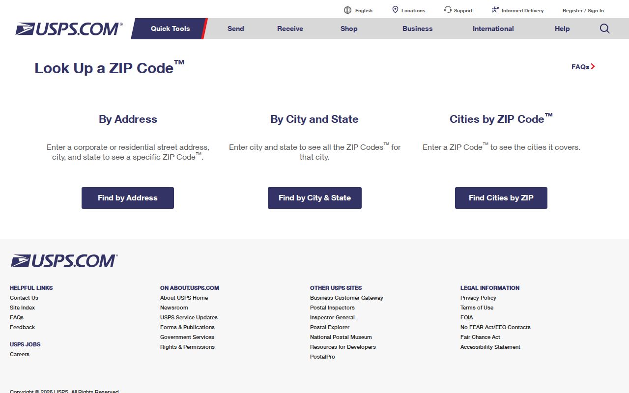
The image illustrates an address-first check. It does not supply a countywide search or replace the county’s parcel and jurisdiction fields.
Marion County Postal Search Workflow
Use one postal area as a qualifier after, rather than before, the street or property identifier is known. The county Property Search has no ZIP-only category, so it cannot responsibly be used to generate all people or all parcels within a postal area. A narrow, address-first path produces a record that can be checked for its own situs, tax-lot, city, and district facts.
- Confirm the exact street address through the official USPS tool when a current delivery presentation is needed.
- Search the Marion County Assessor’s Property Search by Situs Address, Map Tax Lot, Account Number, or Subdivision, using the known property detail rather than a ZIP-only query.
- Open the matching parcel in the Marion County Property Records Viewer and compare Site CSZ, city, tax lot, and available district fields.
- Use the postal result only to check delivery formatting. For a full address-level property trail, use the Marion County street directory workflow.
- For voter information, use secure self-service for the voter’s own record or the separate statutory request channels, not an invented individual ZIP voter list.
When historical material is involved, retain the address exactly as the dated source presents it. A current postal check may use a different city convention, but it does not rewrite the older record. Tax lot, plat, block and lot, recorded parties, and instrument dates are better continuity clues when an older address does not match modern formatting.
Marion County Property Fields After a Match
Once an address produces a county property record, the record can narrow the geographic question more carefully than a postal label alone. The assessor search returns account number, owner name, map tax lot, and situs address. The published parcel layer supplies additional spatial and local-government context. None of these fields authorizes a claim about all people connected to a parcel.
| County field or record | What it helps distinguish | Limit to retain |
|---|---|---|
| Situs Address | The property’s physical address | It is not a roster of everyone present there. |
| Map Tax Lot | A parcel identifier that can bridge assessment, map, and recorded-document research | It is a property key, not a postal code. |
| Site CSZ | County parcel city/state/postal presentation | It is county data, not USPS certification. |
| City and district fields | Municipal, school, fire, zoning, or levy context where available | Confirm the responsible government with its own records when accuracy is required. |
| Parcel geometry | The mapped property shape and nearby land context | The viewer is not a legally recorded survey. |
The parcel layer distinguishes `SITUS` and `SITUSCSZ` from owner-mailing values. A mailing address can be outside Marion County or use a different postal convention. Treat it as a tax-account contact field, not as a second physical location or evidence that a person resides there.
ZIP Codes and Marion County Boundaries
A ZIP code does not equal a city limit. A Salem mailing city can cover locations with different municipal boundaries, and one city can have more than one postal area. The county’s data also indicates that 97002, 97032, 97360, and 97071 can have parcels or delivery patterns extending beyond Marion County. Postal geography is built for mail delivery, while city limits, parcel geometry, service districts, and county boundaries serve different purposes.
That distinction is especially useful across Marion County’s cities and unincorporated areas. A locality name may be a practical mailing clue, yet the responsible jurisdiction for a permit, tax account, school district, or civic boundary must come from the relevant government record. A ZIP code directory can narrow the next check, but it cannot settle that jurisdictional question on its own.
Postal Terms for Marion County Records
These terms keep an address search from mixing delivery details with property and civic records. Use each label for the limited question it answers.
- ZIP
- A postal routing code used with an address. It is not a municipal boundary or a parcel identifier.
- ZIP+4
- An added delivery segment used with a base ZIP for more precise mail sorting. It does not create a separate government jurisdiction.
- PO box ZIP
- A postal code associated with box delivery. The research did not verify a local box-only list, so no Marion County box-only code is asserted here.
- Unique ZIP
- A code assigned for a particular delivery purpose or organization. No local unique-code list was verified in the research.
- Carrier route
- A delivery-sequencing designation. It is not a resident directory and does not define an official city or county boundary.
Note: Preserve the source’s exact postal wording in historical records before comparing it with a current address validation.
Marion County Voter Routes and ZIPs
Oregon My Vote is a secure self-service route for a voter to check registration information, update that voter’s registration, and find a county office. It is not a public ZIP browse tool. The live fields were not available in the inspected entry point, so their labels should not be guessed. A public request channel has different rules and is not evidence that an individual ZIP-based voter directory exists.
ORS 247.945 and ORS 247.948 govern voter-list availability and protected fields. The Oregon Secretary of State Request for Voter List route offers statewide or less-than-statewide electronic lists through SFTP. It states a $500 statewide charge and, for a less-than-statewide electronic list, a $25 setup charge plus 2.5 cents per 100 records, with 10 business days allowed. Hardcopy and label formats belong with the appropriate county elections official, and a county elector-list request has the statutory timing boundary before the 45th day before an election.
For non-personal civic context, Marion County voter-registration numbers publishes dated status, district, precinct, and household-summary materials. Those aggregate files are more appropriate for understanding area context than building a named postal list.
Marion County Postal Privacy Limits
Public availability does not permit an intrusive profile. The Oregon Public Records Law concerns inspection of existing records and does not require the county to create a new compilation. A request should identify the specific record, date range, custodian, and format needed. Never use address, postal, parcel, or voter information to seek a protected location, track a person’s routine, or assemble sensitive data about a neighbor.
Oregon Safe at Home can provide a substitute mailing address for eligible survivors, and protected voter information is excluded from ordinary list access. If a record is withheld or incomplete, accept that boundary. Use the custodian’s process for an existing record rather than attempting to infer a protected address from nearby or unrelated entries.
Dates Matter in Marion County Postal Records
A current preferred city spelling is useful for delivery, but it is not a correction to a historic deed, directory, permit, or archived tax record. Marion County’s property research moves among postal locality, situs, tax lot, plat, block, lot, instrument, city, and district fields. Each is a different geographic lens. Record the date and source beside the label rather than turning a modern lookup into a timeless identity.
The Oregon Blue Book county profile describes a county with Salem, north-county cities, agricultural land, forested areas, and Cascade-edge communities. That varied geography is why a city or postal label needs a companion field: an exact situs, map tax lot, parcel geometry, district, or dated instrument. The ZIP code directory is strongest when it leads to that next precise source.