
Search a Marion County Street
Begin with one verified situs address, not a name list. The county’s property system connects an address to a tax account, parcel identifiers, and an assessor-listed owner. The parcel map can then put that account beside the correct polygon and expose legal or instrument clues. Those clues help with a current property question and may point to recorded title documents. They do not turn a parcel record into an occupant roster, particularly when the owner mailing address and the property address differ.
- Open Marion County Assessor’s Property Search, choose Situs Address, and use a complete or partial address that is already known.
- Save the account number, map tax lot, situs, and any plat, block, lot, grantor, sale, or deed details shown in the property summary.
- Use the linked Marion County Property Records Viewer to confirm the parcel’s location and compare its visible address fields with the tax-account record.
- Carry the tax lot, legal-description clues, parties, instrument number, and date to the appropriate recorded-document index instead of assuming that an old deed can be found by present street address.
- For a voter question, use Oregon My Vote only for the voter’s own secure registration details, or use the statutory request route described later. Do not treat either route as a browseable street roster.
A good street directory workflow preserves the source date at every handoff. It also separates what a source says about a parcel, an owner’s tax account, a recorded instrument, or a voter file. The distinction matters in a county with city addresses, rural routes, changing postal conventions, and records that cover different periods.
Street Directory Fields in Marion County
The assessor form is the most direct address entry point. It is free, refreshes about every 24 hours, and asks the user to select a category before entering a criterion. Its design is useful for examining a street segment because partial situs input is allowed. It is not designed as an owner-name directory. The owner name appears in results only after a permitted address, account, tax-lot, or subdivision search returns a property.
| Assessor field | How the form uses it | Result or limit |
|---|---|---|
| Account Number | Search category for a known account | Use when a prior county record supplies the account. |
| Map Tax Lot | Search category for a mapped parcel identifier | Useful for reconciling address changes or legal records. |
| Situs Address | Search category for the property’s physical address | Partial input is allowed, including the portal’s address-style example. |
| Subdivision | Search category for a named subdivision | Can narrow a property search when an addition or subdivision is known. |
| Search Criteria | Text field, maximum 50 characters | The inspected form marks no individual field required, but instructs users to choose a category and enter a criterion. |
| Result grid | Returned after a valid search | Shows Account Number, Owner Name, Map Tax Lot, and Situs Address. There is no direct owner-name category. |
The county parcel-service field description shows why the follow-up map check matters.
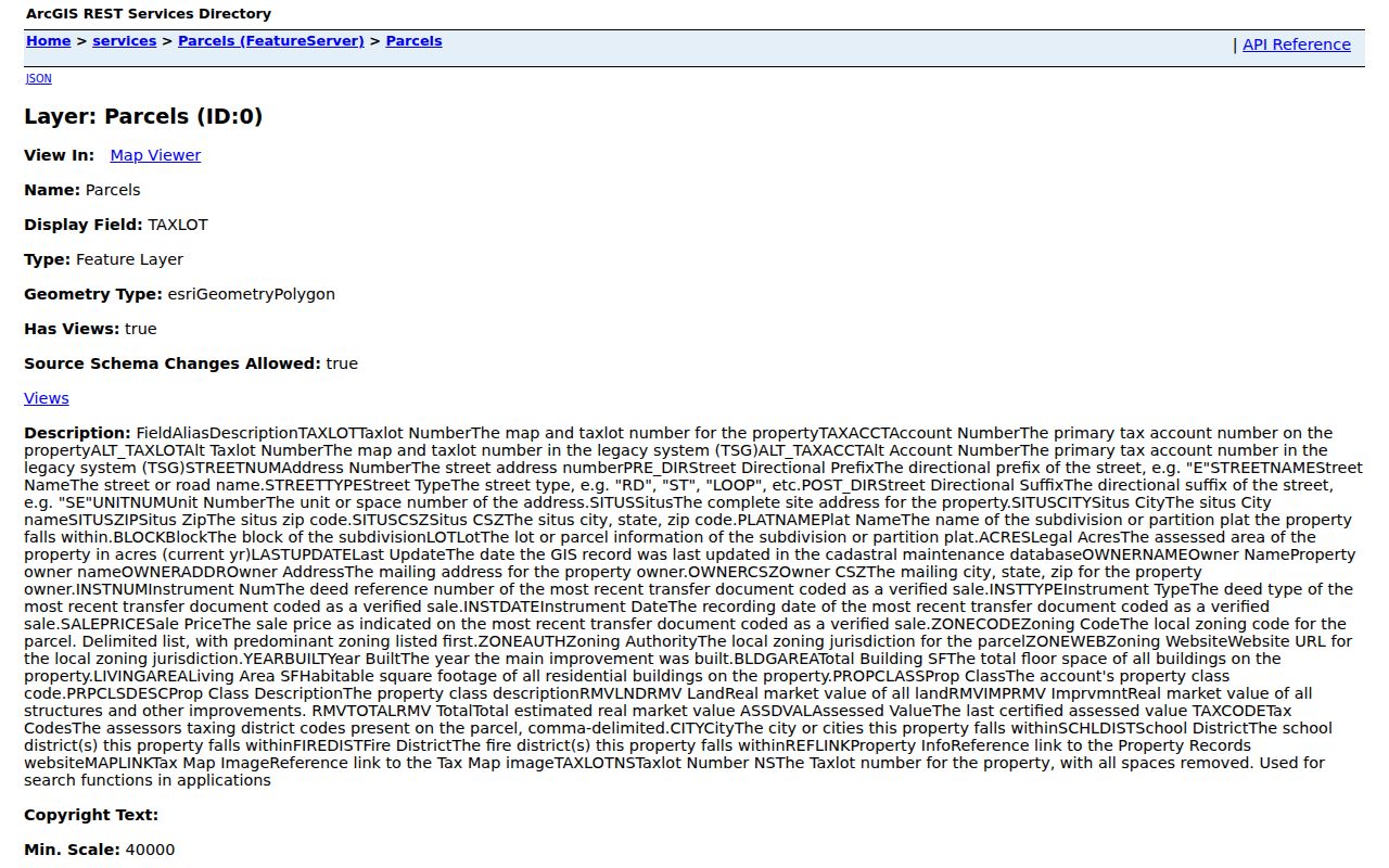
Its separate situs, owner-mailing, legal, instrument, value, and district fields support careful comparisons rather than a quick conclusion about who is present at a property.
Situs and Mailing on Marion County Streets
A situs address identifies the property’s physical location. The parcel layer’s owner-address and owner-city/state/ZIP fields identify where the tax account receives mail. They may match, but they can also differ for an owner who receives mail elsewhere, a business, an estate, or another delivery arrangement. A match is a lead worth corroborating. A mismatch is not evidence that anyone moved, nor does it identify the people inside a home.
This field split is one of the most useful cautions in Marion County street work. The same layer includes tax lot, plat name, block, lot, acreage, city, instrument number, instrument type, instrument date, and sale price. Read those as property and transaction context. The county also warns that its internet mapper is not a legally recorded map or survey, so a displayed line is not a substitute for a surveyed boundary.
Note: Keep physical-address fields separate from tax-mailing fields whenever comparing a parcel, deed, or postal record.
Parcel Terms for Marion County Streets
Address records use several terms that look alike but answer different questions. Carrying the right term forward makes a search more reliable when a street label, unit number, or postal city changes over time.
- Parcel
- A mapped tract tied to a tax account. It can be inspected in the county parcel viewer, but it does not list all occupants.
- Situs address
- The physical address assigned to the property, distinct from the owner’s tax-mailing address.
- Plat
- A recorded subdivision or map reference that can work with a block and lot to identify property in older records.
- Criss-cross directory
- A reverse address-style directory. No live countywide criss-cross catalog or field mechanics were verified in the research, so it should not be promised as a current Marion County search tool.
For a past Salem address, the City of Salem historic-property research guide recommends establishing the ownership chain and then using the addition, lot, and block. It points researchers toward Sanborn maps and city directories, while warning that pre-1932 directory use is name-first. That historical material is different from a modern reverse-address search.
Deed Trails Along Marion County Streets
The recorded-document path has two overlapping local eras. The Marion County Digital Research Room covers recorded documents from 1974 to the present. Its online images are public-service copies and are not certified true, complete, or exact copies. When an official certified instrument is needed, contact the recording office rather than relying on a downloaded image.
The Historic Deed Search form states a 1850 to 1976 range, while the county records navigation labels the historical deeds link 1855 to 1976. The ranges overlap with the modern index from 1974 through 1976. Use that overlap to cross-check a transaction, not to count one conveyance twice. Historic searching is by direct party or grantor, indirect party or grantee, date, and instrument type. It has no address field.
The historic deed index presents the party-and-date route used for older instruments.
Bring a tax lot, legal description, party name, and recording chronology from the parcel record to this form. Its own instructions say direct and indirect historic party searches should initially use only the first letter.
Marion County Address Records by Street
One address can lead to several official records, but each has a narrow purpose. The coverage below keeps the current tax record, spatial parcel context, recorded title trail, permit material, and voter channels distinct. That prevents a street directory result from being read as a single complete account of a household.
| Address record source | What it can show | Access channel and limit |
|---|---|---|
| Property Search | Account, result-row owner name, tax lot, situs, and property-summary details | Free search by account, tax lot, situs, or subdivision. Tax-account ownership is not an occupant list. |
| Parcel viewer | Parcel polygon, situs, owner mailing, legal lot data, districts, and sale or instrument clues | Free map viewer and published feature layer. It is not a recorded survey. |
| Recorded documents | Modern title and instrument evidence | Digital Research Room, 1974 to present. Online images are uncertified. |
| Historic deeds | Party, date, and instrument trail for older deeds or mortgages | Form says 1850 to 1976; county label says 1855 to 1976. Search by parties and legal description, not address. |
| Building Inspection records | Construction or remodel chronology where the office has jurisdiction | ePermitting is the stated route for individual permits after February 1995. Not all records are online. |
For an older address, a tax lot, plat, block, lot, or legal description often survives a changed street presentation better than a text match. The county’s early systems predate standardized modern address use. Keep those stable identifiers with the record date before deciding two references describe the same property.
Permit History on Marion County Streets
Permit material can add a dated construction-history layer to an address, not a resident list or a statement about current conditions. The county’s documented online starting point is ePermitting for individual permits after February 1995, where Building Inspection has jurisdiction. Records outside that scope, older material, or a missing online result may require asking the office whether a counter review or a focused records request is the right route.
The county flagged a permit-requirement update related to stormwater policies effective September 3, 2025. That makes current instructions important when interpreting a permit question. A dated permit entry should be read for the work and record date it shows, rather than being used to assume later alterations or identify everyone connected to the address.
The Marion County Building Inspection page provides the current route for permit and ePermitting information.
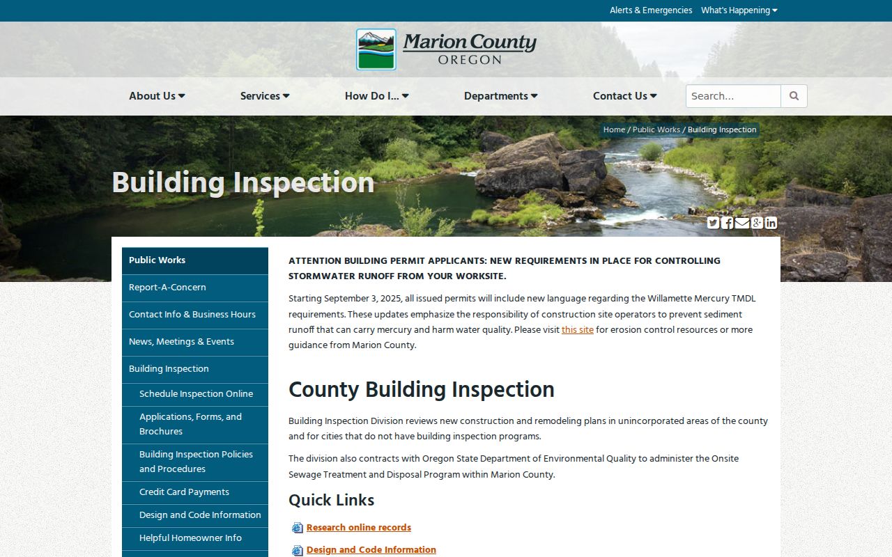
The screen supports a measured permit check: first confirm county jurisdiction and the individual address, then use the current office instructions when the online history is incomplete.
Voter Rules for a Marion County Street Search
Voter information has a stricter route than the parcel system. Oregon My Vote is secure self-service for a voter to check or update that voter’s own registration and find a county office. The inspected entry point did not expose live search-field labels, so no field set should be invented. A street address in a voter context is not a license to compile a neighborhood list or claim that every person at the location is registered.
For public-list access, ORS 247.945 and ORS 247.948 define the available and protected fields. A county elector list is requested before the 45th day before a primary, general, or special election, subject to exclusions. The state voter-list request route supplies electronic statewide or less-than-statewide lists by SFTP, while hardcopy or label formats go to the appropriate county elections official. Ballot status does not reveal ballot choices, and Safe at Home data are excluded.
The Marion County voter-registration statistics provide dated precinct, district, and household-summary files for civic context without a named street extract.
Marion County Streets Need Dates
Address continuity becomes harder as a search moves backward. Street numbers, road names, unit labels, annexations, rural-route descriptions, parcel splits, and postal-city conventions can change. A tax lot, plat, block and lot, township or range reference, or legal description may continue to identify the same land when a street label does not. That is why literal address matching alone is weak evidence for an older deed or directory entry.
The Oregon State Archives Marion County guide also records the earlier Champooick or Champoeg county terminology before the 1849 Marion name. For early material, preserve the spelling, jurisdiction, date, and record reference. The archives can provide assessment, tax, clerk, probate, census, and related evidence, but those period sources are not modern address indexes.
Note: Match an older property reference through its dated legal and party details before treating a familiar street name as proof.
Limits of a Marion County Street Directory
A street directory can document property and record relationships, not a person’s daily location or private life. County records do not authorize efforts to bypass a protected address, locate a child, infer a household from nearby parcels, or confront someone. The public-records process concerns existing records and does not require an office to make a new custom compilation. A narrow request should name the custodian, record, date range, and requested format.
Oregon Safe at Home may provide a substitute mailing address for eligible survivors, and protected voter information must remain protected. If a source is incomplete or restricted, use the custodian’s stated process instead of searching around the gap. The Marion County public-records request process, under Oregon’s Inspection of Public Records Law, is the written fallback for an existing county record.